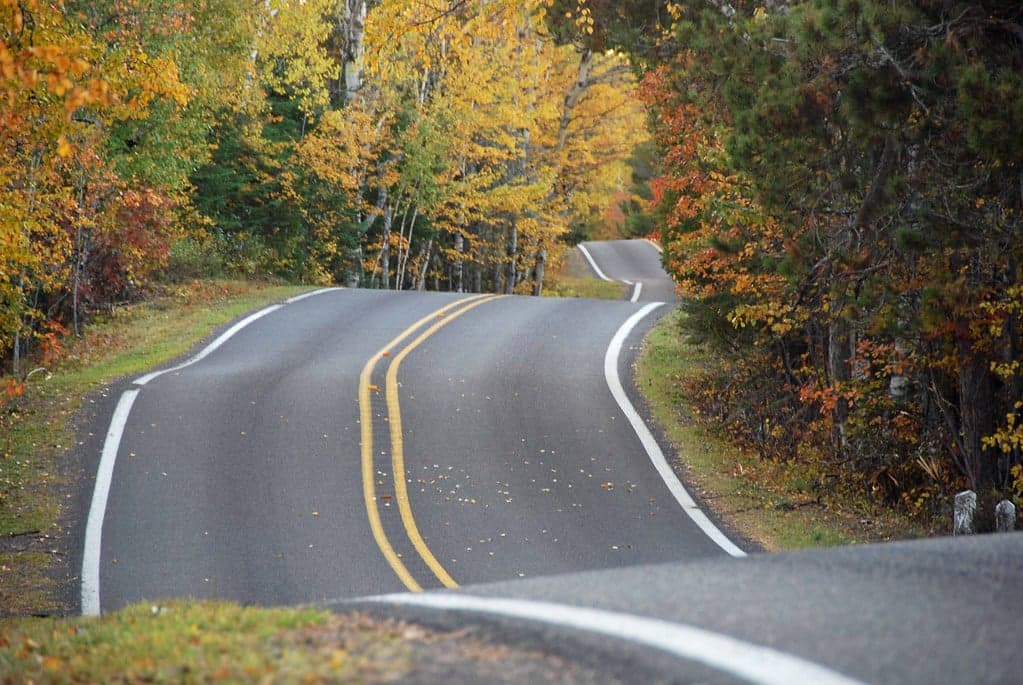
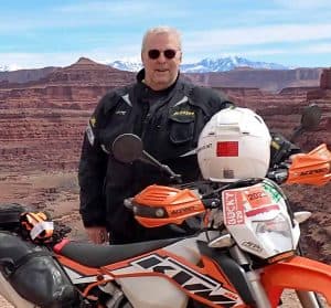
Wisconsin State Partner and Director, Bryan Much is a valued ally in helping NOHVCC meet its mission of creating a positive future for OHV recreation. You can learn more about him and a another of his recent success stories by clicking: Case Study In Perseverance – “Repurposed” Riding In Wisconsin. But this story is about Bryan’s website – cannonshot.net.
Bryan says, “The purpose of cannonshot.net is to share information that may be useful to others in their quest for entertainment via adventure and dual sport motorcycling.
I offer GPS files for download on the site. These will be files that I have scouted and validated. In most cases, I will have included trip planning information including available fuel and points of interest along the way. Riders will be able to download these files and go for a great ride without having to scout or even do much planning on their own.
I also plan to include links to ride reports that will provide a comprehensive picture of some rides and what they involve. Some of these will be significant adventure rides known on a national level and some will be rides more local to the Midwest. The idea here is to share information to encourage people to take on some of these rides themselves.”
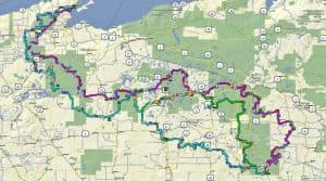
Bryan has posted GPS files for dual sport and adventure bike rides from all over the United States. While, of course, there is more comprehensive coverage of rides in and near Wisconsin, cannonshot.net includes GPS files of rides from the Mid-Atlantic, Arkansas, Minnesota, Utah, and other areas of the Country. Another compelling feature of the website are Bryan’s ride reports. These reports go into detail about places of interest along the route and include well-researched historical accounts tied to the region.
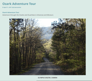
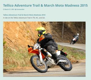
Ride Report Examples:
Cannonshot.net provides plenty of opportunities for those who are looking for great dual sport or adventure bike rides. Please use these routes and reports if you have interest!
If you are inspired by Bryan to create routes/reports of your own, read the below article written by Bryan himself for how to get started:
Planning, Scouting, Mapping, and Sharing GPS Guided Rides (By Bryan Much)
Many of us enjoy GPS guided dual sport or adventure rides. GPS guided rides can be an excellent source of entertainment that can take a rider right to “the good stuff”. Not everyone has the time or inclination to try to develop, document, and share good routes on their own. Drawing from a catalog of GPS based rides allows people to make the most of the time they have available for riding in an area.
Whether it is an informal get-together, a structured event, or a few rides for rally goers, doing some work ahead of time to document riding opportunities can set-up a great experience.
Providing a catalog of rides for an area allows people to ride on their own schedule and in groups that best fit their riding preferences.
GPS guided rides that are publicly shared must be responsibly prepared and validated to ensure that they only use allowable paths.
Some may be interested in scouting and mapping routes to share with other riders but aren’t quite sure of how to go about it. In this article, I’ll explain some methods that can be used to get that done.
LOOKING FOR OPPORTUNITIES
After identifying a region to explore, I do a map recon to find areas that might offer some interesting segments. I review Motor Vehicle Use Maps (MVUM), official state forest maps, trail maps, topographical maps, recreation maps, aerial imagery, official county highway maps, and more. Official maps help me distinguish between private and public roads or lands and often indicate restrictions on some paths. Look for restrictions related to motorcycles that may be imposed on commercial forest lands open to public use and whether or not off-highway motorcycles are allowed on a particular ATV trail.
Some government entities offer a geographic information system (GIS) viewer that allows users to apply various layers to a map of an area. In my state, roads in state forests are identified in a viewer by their level of development and the date window they are open for motorized use. Keep in mind that not all maps, including official maps, are as accurate as you might expect. Some data is derived from aerial images or other sources instead of on the ground mapping.
ON THE GROUND SCOUTING AND VALIDATION
The next step involves getting out on the ground and physically scouting segments in an area to see what the characteristics are. To do this efficiently, I draw a GPS guided scouting track that takes in all of the segments I need to look at. I thread a bunch of separate segments together into a single linear path. Following the path can be a little inefficient. It involves a lot of out and back runs and overlapping of paths to be able to cover everything of interest in an area. To save some time, I review my stock of previously recorded raw and published tracks to make use of the information I already have. Inspecting, recording, and otherwise validating segments can be tedious. This is particularly true when you encounter unexpected obstacles or closures that require you to abandon your intended track and take a different route.
A handy way to deal with trying to work out go-arounds in the field is to load the track and some background maps onto a small tablet. When you need to work out some re-routes while in the field, it is a lot easier to scroll and zoom on a larger tablet than it is to try to work through it on a small GPS screen – especially if the screen flips around with movements of the GPS unit.
Since scouting sometimes involves checking almost every path in an area, you can spend a lot of time and miles out in the boonies away from gas stations. Try to have enough fuel on-board to support your scouting to avoid time-consuming side trips to services.
When scouting I use waypoints as temporary “notes” to mark some of the best features on a path. Repeated waypoint markings on a draft segment can be used like a star rating for quality. Five rapidly placed waypoints might equate to five stars. Look for places that are better to avoid, even if they are legal, just because it can cause a problem later on. I also make written notes on a map or in a notebook as required.
Enhance your scouting with the right background map on the GPS unit. Some aftermarket maps do a great job of delineating private versus public land. This is also part of the map review process.
BUILDING ROUTES TO SHARE
After sorting through all of the information, and considering the other important issues related to riders and their preferred experiences, I go to work laying out specific paths to share publicly.
Building rides requires thoughtful consideration. It involves more than just threading together the best segments. Consider the fuel range of the bikes that will be involved to ensure that the path leads to fuel stops when needed. Sometimes that can be a problem and in those cases advise riders that use the tracks to take along extra fuel. Points of interest in an area can be included in the file.
Try to mix it up a bit. Instead of extended segments involving a single type of experience, add some variety to keep a rider’s interest. For example, after including some segments of single track or sandy two-track, it can be good to steer riders out onto a twisty road for a bit to allow them to relax on the handlebars and enjoy a cooling breeze.
Consider the riders that will enjoy these routes. Not every rider wants an all-day butt-kicking. Advise riders about some of the challenges up front. Be reasonable with the paths you lay out. “Hero sections” are great but offer alternatives for riders to by-pass difficult segments that might be beyond their comfort level.
COORDINATING WITH LAND MANAGERS
Even though these paths are not formally designated trails, I find it valuable to coordinate with some land managers to make them aware of the path. The intent is to establish a relationship so that if there is a problem or if a change needs to be made the land manager knows who to contact to work things out. This proved to be valuable in the past. In fact, some land managers offered suggestions about additional interesting segments for us to enjoy.
Some people may be wary about whether a land manager might take steps to discourage this kind of activity. I have had great success by giving information briefings to land managers at the federal, state, and local level explaining how all this works. As is often the case, understanding can bring acceptance. Land managers usually prefer to have a contact related to all this as I mentioned earlier. Keep in mind that some land managers might not favor motorized recreation, but if the rules permit it there usually isn’t much anyone can easily do to stop it.
Consider potential conflicts with other people in the area. We may have a right to be there, but it might not be in our best interest to aggravate a group that might oppose us. Sometimes it is better to route away from potential conflict.
SHARING GPS FILES
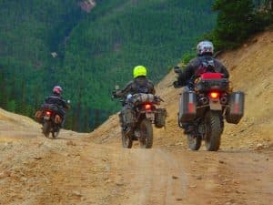
When publishing a catalog of tracks, index them by area and/or type of ride. Show an overview map and some basic information about the length of the route and gas intervals. Indicate whether the path is intended for small/medium dual sports or big adventure bikes. Often I’ll get questions like “Can I ride my KLR on this?” Since rider abilities vary, I find it best to show some sample photos from the path for riders to consider. Let them look at the pictures and decide for themselves if it is a good path for a particular rider and bike.
Some people ask about trying to use a printed map versus following a track using a GPS unit. I seldom recommend a map by itself. Once you are deep in the forest, trying to use a map can be a challenge in some circumstances. If you miss a turn or have to devise a temporary go-around, knowing your exact position via GPS is helpful. Following a GPS track line makes it easy to deal with obscure or confusing turns, confirm you are on the right path, or get back on track.
Don’t publish files with paths that violate the rules. The last thing any program needs is for those that oppose our recreational activity to get hold of tracks that go where they shouldn’t. Keep control of the tracks you publish. Share them from a single source location. That way, as updates are made only the current version of the track will be available. Land use changes can require adjustments. We don’t want to have an old version of a track out there guiding people to places where they are no longer allowed.
WRAPPING IT UP
Much of what we covered here involves typical day rides that someone might put together for an area. I share a catalog of rides that also includes multiple rides based out of a few base locations. This works well for long weekends or for rallies where people might want to ride on their own schedule and in their own small groups without the hassles of being led on a large group ride.
I also scout and map long adventure rides. These can take in a variety of points of interest or may relate to a theme associated with the ride. Although many of the practices involved with day rides can apply, planning for long adventure rides can be a bit different . . . but that is another story that I’ll take up in a future article.
I hope this proves helpful to those that are interested in scouting, mapping, and sharing rides. Perhaps it will encourage a few others to create some more quality riding opportunities for riders to enjoy in their regions.
Some of my ride catalog can be found at https://cannonshot.net/wp/category/gps/ .
Looking forward to seeing more GPS guided ride opportunities!